Orbital Technical Solutions prides itself on providing optimal, cost effective and intelligent solutions for your inspection, surveying, mapping and modeling needs. Working with a variety of UAS platforms and our proven processes we produce high resolution aerial photography, highly accurate and detailed topographic data and high resolution maps and models for a variety of applications. Using suitable small UAS platforms which are portable and field repairable, we are able to reduce costs, save time and improve safety. OTS applies advanced technology to solve asset management problems in the Energy, Mining, Metals, Chemicals and Manufacturing Industries. Our UAS solutions reduce costs, minimize worker exposure to safety hazards, and eliminate plant outages while performing aerial surveys and inspections of high rise, underground or difficult to access assets.

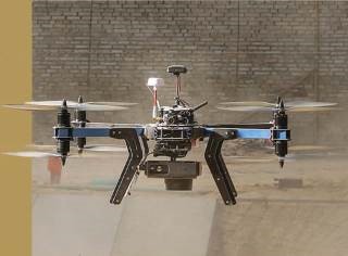
3D Robotic Mapping Drone with
12MP Cannon S110 Camera
Unmanned Aircraft Systems (UAS)
- Reduce Inspection Personnel Exposure & Risk
- Aerial mapping
- Difficult to access inspections:
- Bridges
- Stacks
- Flares
- Conveyors
- Transmission lines and Towers
- Trusses/Complex Framing
- Internal Inspections
- Boilers
- Stack Lines
- Vessels/Tanks
- Sewers/Culverts
- Roof Trusses
- Surveys and topographic maps
- Storm Water Runoff Drawings
- Contour Drawings
- Containment Area Validation
- Stockpile measurement
- Validation of Material Inventory
- Landfill monitoring
- 3D capture
- Photogrammetry
- Dense point clouds and CAD models
- Pipeline inspection and leak detection
- Roof inspection
- Thermal Imaging
- Stacks
- Process Sewers
- Electrical Equipment
- Process Equipment
- Gas Leak Detection
- Emergency Response
- Pipeline/Transmission Line Asset Mapping
- Construction Site Monitoring & Material
- Laydown Mapping
- Capital Project Planning
- Crisis Management
- Accident Reconstruction
- Environmental Monitoring
- Pollution and industrial events
- Storm water management
- River erosion at docks
- Leak detection
- Plan Upgrades based on environmental assessment with drone
- Resolve disputes over power plants’ impact on endangered wildlife
- Right of way investigations
- Validating/Assessing Wildlife impacts

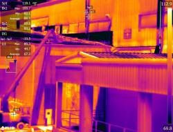
IR Scanning Capabilities

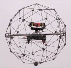
Carbon Fiber Encased Interior Inspection Drone that provides protection from structures

